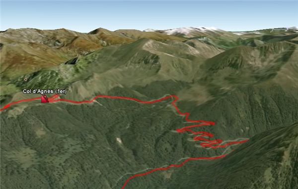
Google Earth has one of the liveliest user/contributor communities around, and there always seems to be people putting the program to new uses. This weekend sees the start of the Tour De France, and if you’d like an interactive map of the grueling route, try this Google Earth file. Zoom in over a mountainous part, and use tilt to get a good idea of just how painful parts of the race will be! There’s an extended description of the route at creator Thomas Vergouwen’s blog.
All you need to do to view it is open Google Earth, and download the file. Select ‘open with Google Earth’, and you should see the red route with various flags and icons stuck over France. Check back at Thomas’ blog to see if there are real time updates available, so you can track progress on your Google Earth map. Check out this impressive YouTube video flypast of one of the mountain stage:
[youtube]http://www.youtube.com/watch?v=onyVutrfBzA[/youtube]